
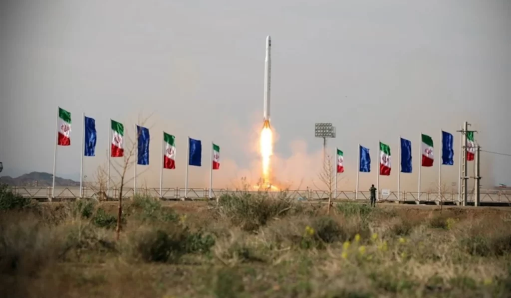
Using a satellite carrier called “Ghased” built in Iran, the Islamic Revolutionary Guard Corps Aerospace Force successfully sent the imaging satellite Noor 3 into orbit approximately 450 kilometres above the surface of the Earth. This accomplishment was announced by Major General Hossein Salami, the Commander-in-Chief of the Islamic Revolutionary Guard Corps, during an event called “Yadha va Nam-ha” (Memories and Names) held on September 27 at the Basij Organization’s Hall, according to a report from the political correspondent of the Tasnim News Agency.
Additionally, Minister of Communications Eisa Zar’ei-Pour congratulated the successful launch of the Noor 3 imaging satellite on his page. He stated that with the help of the experts of the IRGC Aerospace Force, the Noor 3 imaging satellite was successfully placed into orbit at an altitude of 450 kilometres above the Earth using the Iranian satellite carrier Ghased. He added that he would want to use this opportunity to congratulate citizens, the professionals who work so diligently in the country’s space industry, and the experts who serve in the IRGC Aerospace Force on this accomplishment.
Previously, on April 22, 2020, the IRGC Aerospace Force put the Noor 1 satellite into orbit at an altitude of 425 kilometres, and on February 26, 2022, they put the Noor 2 satellite into orbit at an altitude of 500 kilometres.
The experts from the IRGC Aerospace Force were responsible for developing the Ghased satellite carrier, which was used in all three of these launches. According to Commander Haji-Zadeh, who is in charge of the Aerospace Force of the IRGC, the demands placed on space by the armed forces are substantial, and without access to space, a great deal of work cannot be finished. Real-time data transmission over long distances, for example, for drones and maritime vessels, and ultimately global positioning services for missile guidance systems, military equipment, and personnel, are among the most critical needs of a military force for satellite services. Some activities under this category include high-quality and high-resolution imaging in various optical spectra, telecommunications relay services, real-time data transmission over long distances, etc.
